HEART OF NEOLITHIC ORKNEY
Skara Brae, Ring of Brodgar & Stones of Steness — a long day to the edge of the known world
The journey itself is part of the experience, and you should approach it that way. From Inverness we took a private bus north through the Scottish Highlands — a landscape that shifts from heathered moorland to bare rock and coastal cliff as you push toward the top of the mainland. The drive to John O'Groats takes roughly three hours depending on stops.
From John O'Groats, a passenger ferry crosses the Pentland Firth to Burwick on the southern tip of South Ronaldsay, the southernmost island of the Orkney archipelago. The crossing takes about 40 minutes and offers the first glimpse of the Orkney coast — low, green, and treeless, rising out of the grey sea.
On Orkney itself, a bus connects the sites. The landscape opens up immediately: it is flat, exposed, and unlike any part of mainland Britain. There are no trees. Not one visible.
| Leg | Mode | Approx. time | Note |
|---|---|---|---|
| Inverness → John O'Groats | Private bus | ~3 hours | Scenic Highland drive along the A9/A99 north coast road. |
| John O'Groats → Burwick (Orkney) | Passenger ferry | ~40 min crossing | Seasonal service; search current operators on GetYourGuide as services change between seasons. |
| Orkney: Burwick → sites | Bus / organised tour | Variable | Sites are spread across the mainland of Orkney; a guided bus tour coordinates the sequence. |
| Return ferry + bus south | Ferry + bus | ~3.5–4 hours | Plan a full day — allow for weather delays on the Pentland Firth crossing. |
The UNESCO inscription covers four principal Neolithic monuments: Skara Brae (the village), the Ring of Brodgar (stone circle and henge), the Stones of Steness (stone circle), and Maeshowe (a chambered cairn). Together they form what may be the most concentrated and best-preserved Neolithic ceremonial and domestic landscape in western Europe, all dating to between 3000 and 2500 BCE.
What makes the Orkney ensemble exceptional is not any single monument but the relationship between them. This was a living Neolithic community with a ceremonial centre: people lived at Skara Brae, gathered and marked time at the stone circles, and buried their dead in passage cairns. The monuments speak to each other across the landscape and across five thousand years.
Skara Brae is extraordinary. It is one of the best-preserved Neolithic villages in the world, and one of the most important archaeological sites anywhere in northern Europe. The settlement was occupied for roughly six centuries, from around 3180 to 2500 BCE — a span of human habitation that makes it older than the Egyptian pyramids and Stonehenge by several generations.
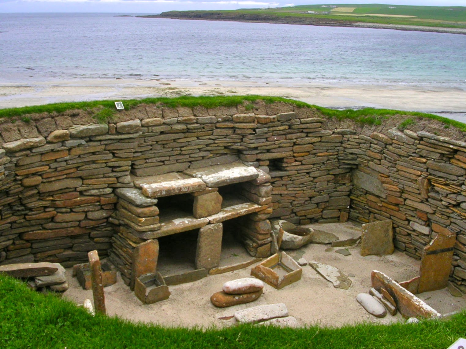
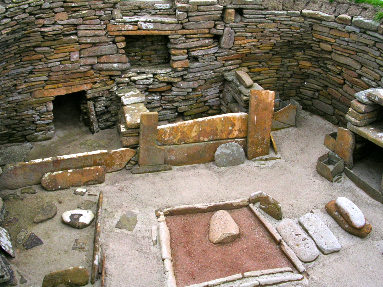
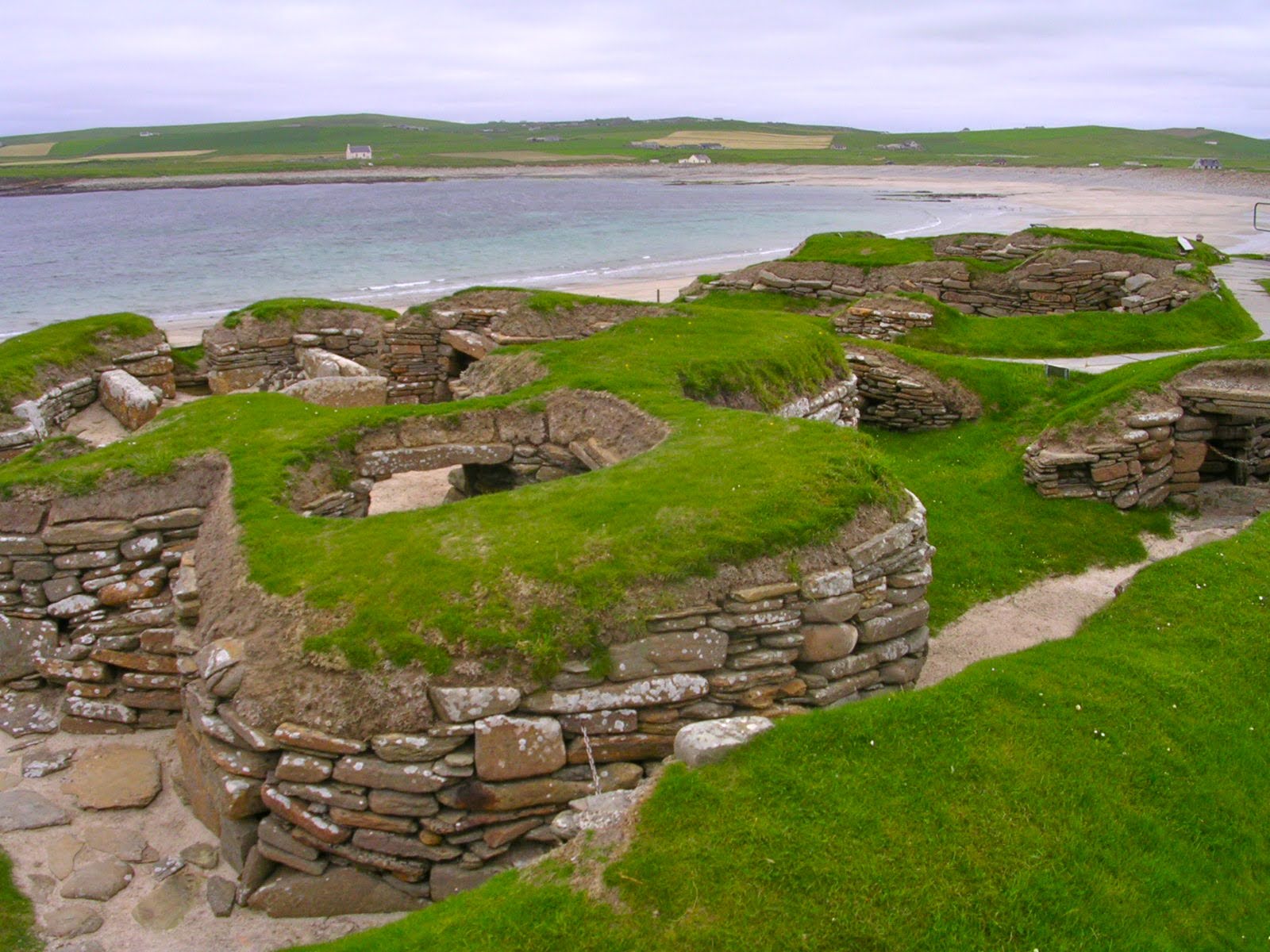
The village lay buried under coastal dunes for nearly five thousand years. A violent storm in 1850 stripped the dunes away and exposed what lay beneath: eight stone houses, connected by covered passageways, their furniture still in place. Stone furniture. This is the detail that arrests you. Because organic materials like wood cannot survive in Orkney's damp climate, the inhabitants built everything from stone — the only durable material available. What remains are their stone dressers, stone beds, stone hearths, and stone storage boxes, all in situ, exactly where they stood when the village was abandoned around 2500 BCE.
Each house is roughly square, with a central hearth, stone box beds on either side (likely filled with heather, bracken, or animal skins), and a large stone dresser facing the entrance. The dresser would have been the focal point of each home — the place where valued objects were displayed. There is something profoundly human and immediate about this arrangement: it is recognisably domestic in a way that a stone circle never can be. You understand these people not as ritual actors but as people who slept, ate, and stored their belongings.
The passageways connecting the houses are low and require stooping. This was deliberate — perhaps to keep out cold, wind, and predators, perhaps also to enforce a kind of social intimacy. The settlement functioned as a single, interconnected structure rather than isolated units. No one lived alone here.
Modern archaeology has revealed traces of colour on some surfaces, ochre pigments suggesting that interiors were decorated. Personal ornaments — beads, pendants — were found here, indicating a sense of individual identity and adornment stretching back fifty centuries. A carved stone ball of unknown purpose was also discovered, similar to others found across Neolithic Scotland, whose function remains genuinely unknown. That uncertainty is part of what makes Skara Brae so compelling: it is intimate enough to feel familiar, and strange enough to remain partly mysterious.
The visitor centre provides essential archaeological context before you descend to the site. Walk the path around the village edge and look down into the exposed interiors. The scale is domestic — these were not monumental spaces but lived ones. That is what makes them so striking.
The Ring of Brodgar is a large stone circle and henge on a narrow isthmus between two lochs, Harray and Stenness. Originally it consisted of 60 standing stones; around 27 remain standing today. The ring was constructed between 2500 and 2000 BCE, making it slightly later than Steness. The surrounding ditch, cut into bedrock, required significant communal labour and points to the ritual importance of this site as a gathering place — a monument built not just to mark the land but to define a boundary between the sacred and the everyday.
The setting intensifies the effect. On a grey day under Orkney's enormous sky, with the lochs reflecting cloud and the grass bent by wind, the stones feel genuinely elemental. There is no visitor centre here, no interpretation boards that interrupt the view. You simply walk into the ring and stand among the stones.
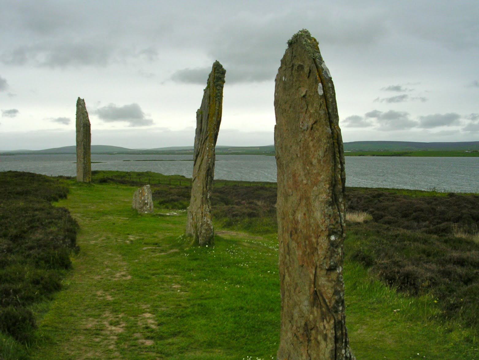
The Stones of Steness are among the oldest standing stones in Britain, erected around 3100 BCE. Four tall stones survive from what was originally a circle of twelve, set within a henge — a circular ditch with a surrounding bank. Even reduced to four, the stones command the landscape with a quiet authority. They are taller and thinner than the Brodgar stones, and the light plays differently on them depending on the time of day and the state of the Orcadian sky, which changes constantly.
Steness and Brodgar sit less than a kilometre apart on the same isthmus, which suggests this whole zone between the lochs functioned as a unified ceremonial territory. The concentration of ritual monuments in such a confined area is without parallel in northern Britain.
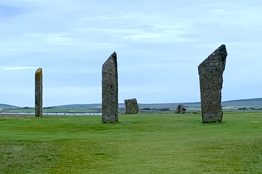
Orkney is a place of particular physical strangeness that stays with you. Several things stand out immediately.
No trees. The wind off the North Atlantic is constant and strong enough that trees simply cannot establish themselves across most of the archipelago. The landscape is open grass, moorland, and stone down to the cliff edges. The few trees that do exist on the islands are curiosities — sheltered specimens in walled enclosures, not a natural canopy. The effect on the light and the view is total: the sky is enormous, the horizon unobstructed in every direction, and the scale of the land makes the ancient monuments feel even more exposed and intentional.
How far north is Orkney, really? The islands lie at around 59 degrees north. To grasp what that means, try translating that latitude to the southern hemisphere: 59 degrees south is open ocean — the Southern Ocean, well south of any inhabited land. Even Cape Horn, the storm-battered southern tip of South America and the most southerly point of any continent outside Antarctica, sits at roughly 56 degrees south. Orkney is further from the equator than Cape Horn. There is no equivalent landmass anywhere in the southern hemisphere at this latitude. You are standing somewhere that has no southern mirror.
The midnight golf contest. Around the summer solstice, Orkney's latitude means the sun barely dips below the horizon — sunset falls well past midnight, and the sky never fully darkens. The island uses this for exactly what you would want it to: an annual golf contest played entirely in natural light at midnight. It has been a local tradition for over a century. It is not a gimmick but a celebration of where these islands happen to be on the earth.
Yes, but it is a genuinely full day. The bus to John O'Groats, ferry crossing, on-island travel, three site visits, and return journey add up to eight to ten hours of continuous movement. It is exhausting and exhilarating in roughly equal measure.
Skara Brae is archaeologically the most significant — a complete, furnished Neolithic village with no equivalent anywhere else in Europe. The stone circles (Brodgar and Steness) are more visually dramatic and emotionally powerful in an immediate landscape sense. See all three; they are within manageable distance of each other.
Without hesitation. It is one of those places that justifies the effort precisely because the effort makes it feel remote and serious. The landscape, the monuments, and the sheer age of everything you look at combine into something that is difficult to find elsewhere in western Europe.
Late spring and summer (May to August) offer the best light and the long evenings that make the islands feel extraordinary. The winter solstice at Maeshowe — when the setting sun illuminates the inner chamber — is one of the most famous experiences in British archaeology, but visitor access to that event is controlled by ballot. Avoid January and February unless you enjoy very serious weather.